

Map Gallery
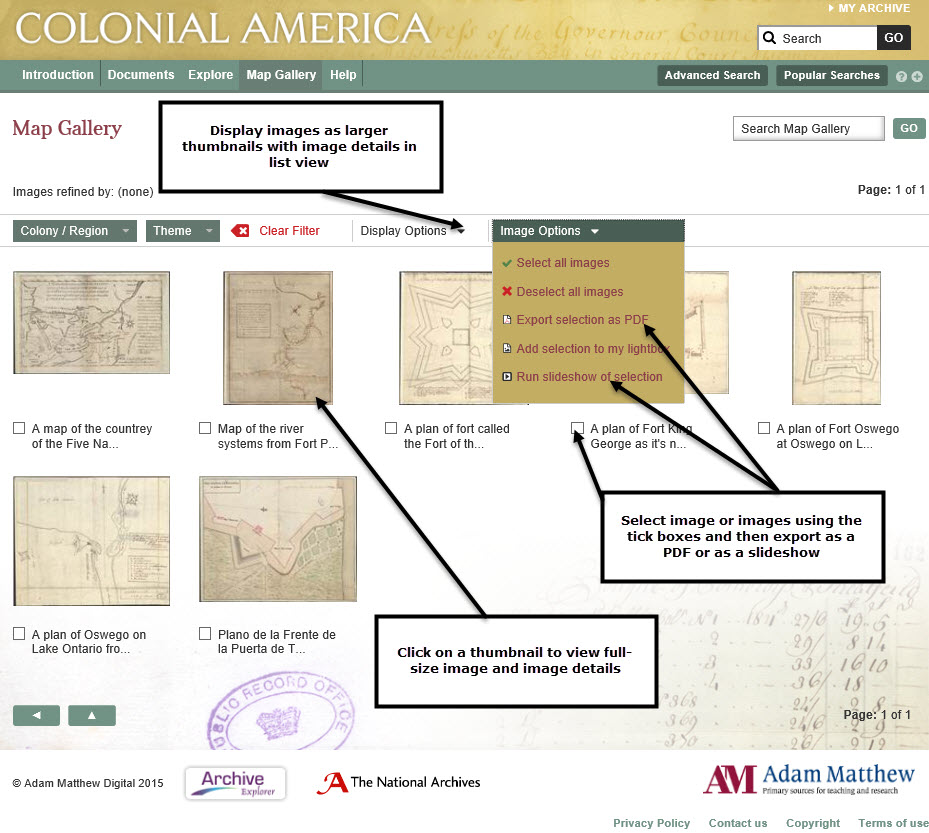
The Map Gallery displays the numerous maps, many of them in colour, which accompany the CO 5 series. You can filter the gallery by image type, periodical or date, or search within it using the box at the top right. By clicking on a map you can view the full-size images and related metadata. Features also include downloading images as PDFs, running a slideshow or create your own bespoke collection of images using the 'My Lightbox' function.
Next: My Archive
Previous: Government Structure Chart